Geographical Details of Iceland
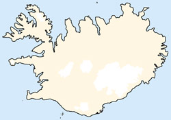
Iceland is a rather large island with a size of 103,000 square kilometers (39,768 square miles) and is situated directly under the polar circle, with a shortest distance of 280 kilometers from Greenland, 420 kilometers of the Faroes and 800 kilometers away from Scotland. With a population of bit more about 384,000 people Iceland is the most thinly settled state of Europe. Over half of the Icelanders live in the region of the capital Reykjavik.
Position and surface area
Iceland is sutuated in the North Atlantic Ocean between the 63rd und 66th °N and 13th und 24th °W. The shortest distance to Greenland is about 286 kilometers and 950 kilometers to Norway.
Position:
| North | 66°32´29´´ N |
| South | 63°23´31´´ N |
| East | 13°30´06´´ W |
| West | 24°32´12´´ W |
Iceland has a similar area as the state Virginia in the USA or aout 80% of the area of England.
Total area: 103,000 km²
Total area including fishery: 758,000 km²
Main island: 102,700 km²
| Wasteland | 62.6 % |
| cultivated area | 1.5 % |
| Greater Reykjavik | 1.0 % |
| Grassland | 1,3 % |
| Lakes | 2,9 % |
| Forest | 1,5 % |
| Glaciers | 11,6 % |
| Lava | 11 % |
Coastline:
| Küstenlinie: | 6,088 km |
Topographic details
The largest islands beside the main island:
| Heimaey (Westman Islands) | 13.4 km² |
| Hrísey (Eyjarförður) | 8.0 km² |
| Hjörsey (Mýrar, Faxafloí) | 5.5 km² |
| Grímsey (North Iceland) | 5.3 km² |
| Flatey (Skjálfandi bay) | 2.8 km² |
| Málmey (Skagafjörður) | 2.4 km² |
| Papey (Southeast coast) | 2.0 km² |
| Viðey (Bay of Reykjavik) | 1.7 km² |
| Surtsey (Westman Islands) | 1.7 km² |
The largest lakes and their max. depth:
| Þórisvatn * | 88 km² | 113 m |
| Þingvallavatn | 83 km² | 114 m |
| Lögurinn | 53 km² | 112 m |
| Mývatn | 37 km² | 4 m |
| Hvítárvatn | 30 km² | 85 m |
| Langisjór | 26 km² | 73 m |
| Skorradalsvatn | 15 km² | 57 m |
| Svínavatn | 12 km² | 39 m |
| Öskjuvatn | 11 km² | 217 m |
| Jökulsárlón | 8 km² | 260 m |
* Due to structural measures Þórisvatn is the largest lake of Iceland today. But the largest natural lake is Þingvallavatn.
The longest rivers and their watersheds:
| Þórsá | 230 km | 7,500 km² |
| Jökulsá á Fjöllum | 206 km | 7,850 km² |
| Hvítá/Ölfusá | 185 km | 6,100 km² |
| Skjálfandafljót | 178 km | 3,950 km² |
Glaciers and Ice caps:
| Vatnajökull | 8,300 km² |
| Landjökull | 953 km² |
| Hofsjökull | 925 km² |
| Mýrdalsjökull | 596 km² |
| Drangajökull | 160 km² |
| Eyjafallajökull | 78 km² |
| Tungnafellsjökul | 48 km² |
| Snæfellsjökull | 11 km² |
| All glaciers | 11,922 km² |
The highest and most importent mountains:
| Hvannadalshnúkur | 2,119 m |
| Báðarbunga | 2,000 m |
| Kverkfjöll | 1,920 m |
| Snæfell | 1,833 m |
| Hofsjökull | 1,765 m |
| Herðubreið | 1,682 m |
| Eiriksjökull | 1,675 m |
| Eyjafjallajökull | 1,666 m |
| Hekla | 1,491 m |
| Mýrdalsjökull | 1,480 m |
| Snæfellsjökull | 1,446 m |
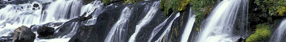
The highest and most important waterfalls:
| Morsárfoss | 227 m |
| Glymur | 190 m |
| Háifoss | 122 m |
| Hengifoss | 110 m |
| Seljalandsfoss | 65 m |
| Skógafoss | 62 m |
| Dettifoss | 44 m |
| Gullfoss | 32 m |
| Ófærufoss | 26 m |
| Goðafoss | 12 m |
| Öxaráfoss | 10 m |
| Svartifoss | 8 m |
The Population of Iceland
Iceland has about 384,000 inhabitants, which is nearly similar to the city of New Orleans in the USA or Leicester in England. The densely populated area of Iceland is Greater Reykjavik. The share of foreign nationals is about 0.16 percent.
The following table shows the geographical population distribution in Iceland. (Last update: 01.01.2024)
| Population | 383,726 |
| Population density | 3.725 Inhabitants/km² |
| Capital region | 244,177 |
| thereof Reykjavik | 135,714 |
| Southwest Iceland | 30,933 |
| West Iceland | 17,419 |
| Westfjords | 7,168 |
| Northwest Iceland | 7,294 |
| Nordeast Iceland | 31,574 |
| thereof Akureyri | 18,542 |
| East Iceland | 11,085 |
| South Iceland | 34,076 |