Greenland
Geography & Climate
Greenland is with more than 2,175 mio. square kilometers more than six times as big as Germany and therefore the biggest island in the world. It is around 2,650 kilometers long (north-south) and up to 1,000 kilometers wide (east-west). The most northern point of the island is only 740 kilometers away from the north pole. The most southern point is nearly on the same level as Oslo.
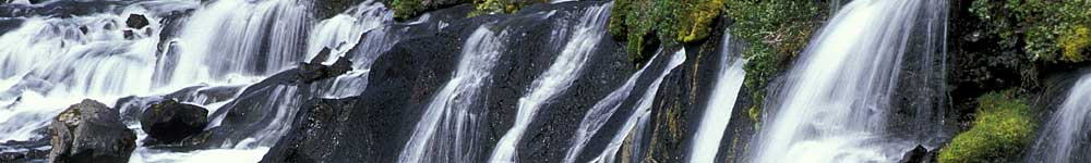
The biggest part of the country is covered by the great inland ice. This layer of ice is the second biggest connected mass of ice in the world and has a thickness of average 1,500 meters. In some places the ice is up to 3,500 meters thick. Only about 16% o the island are free of ice. The inland ice is no result of today’s world climate, but more than anything the remains of the last Ice Age, which ended about 10,000 years ago. The worldwide global warming however is also noticeable in Greenland. In the last years the layer of ice melts quicker than before and decreases each year by around 240 square kilometers.
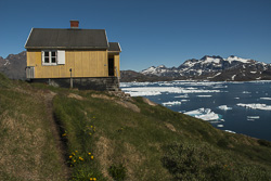
Geographically Greenland belongs to the arctic North America, however politically it is an autonomic part of the Danish kingdom. This autonomy status is existent since 1979. In 1985 Greenland was the only country to ever leave the European Community. In the foreign policy Greenland is represented by Denmark, while domestically it is completely independent. Human settlements are located in the east, south and west of Greenland. In total only 57,000 people live on the biggest island in the world, of which 15,000 live in the capital Nuuk. About 88% of the population are Greenlanders, so descendants of the Kalaallit, a subgroup of the Inuit.In a bit bigger cities live a european minority, especially Danish, which make around 12% of the population.
History
The ancestors of the first of Greenland’s Inuit came over the Behring Street from Asia to Alaska and spread across north Canada. 4,500 years ago they started the first immigrations to Greenland. From that time hunting spots are known for example in the Disko Bay in western Greenland.
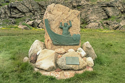
The first Europeans to settle on Greenland were vikings from Iceland. Around 875 the viking Gunnbjørn discovered the island and called it Gunnbjørnland. At an Althing in Iceland Eric the Red was outlawed in 982 because of a homicide during a dispute and banned from the country for three years. The popularity of Eric the Red is indicated through the fact that after three years, in which he had endured diffcult living circumstances in the far away Greenland, 25 expatriate ships from Iceland followed. During the long journey of 2,000 kilometers 11 ships sank in the stormy sea or turned around. The few settlers that reached their destination, found in the quiet fjords fields covered in flowers, on which the cattle, that had been brought over under difficult circumstances, could graze. About 100 years after the beginning of the land taking in Iceland the vikings also settled in Greenland. With his companions Eric the Red settled from 986 onwards in the area around Brattahlið in southern Greenland.
When we meet today the last visible signs of the settlement through the vikings around 1,000 years ago, it is difficult for us to understand, that 3,000 people lived on Greenlands coast in widely spread settlements for 300 years. As hostile as Greenland may seem to us today, it became home to many vikings. The viking colony even had a bishop in its best times who had connections to Rome.
Over the remarkable period of 300 years an agile shipping traffic had developed between Greenland and Europe, which decreased for still unknown reasons and finally stopped completely. When no more news came to Scandinavia from Greenland, the Norwegian King Magnus Eriksson sent out expeditions in the middle of the 14th century, in order to find out about the destiny of the Greenland vikings. The search troops could only find deserted settlements and remains of walls - no living settlers. The whereabouts of the Greeland vikings is unclear until today.
Key facts on Greenland
| Location | North: 83°40' north latitude |
| South: 59°46' north latitude | |
| West: 73°08' west longitude | |
| East: 12°08' west longitude | |
| Area | 2,166,086 square kilometers |
| Costline | 44.000 km |
| Highest mountain | Gunnbjørns Fjeld (3.693 m) |
| Capital | Nuuk (64°10' N 51°43' W), 16.800 Einwohner (Januar 2014) |
| Inhabitants | 56.400 (January 2013) |
| Population density | 0,026 inhabitants per square kilometer |
| Official languages | Greenlandic, Danish |
| Monarch | Margrethe II. |
| Currency | Danish Krone (DKK) |
| National holiday | 21. June |
| Country Symbol | GRØ or GRO |
| Calling code | + 299 |
Photo gallery South Greenland: South Greenland (Narsarsuaq)
Photo gallery East Greenland: East Greenland (Kulusuk/Tasiilaq)